South Africa
Southern Africa
UK
Campsites (Africa)
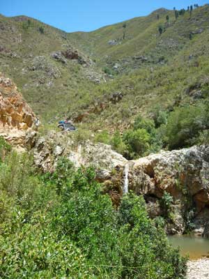
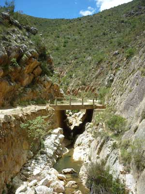
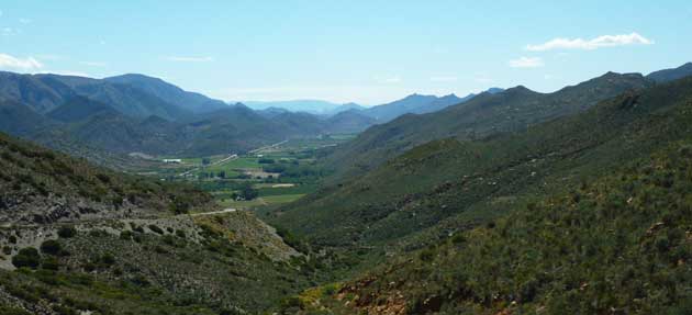
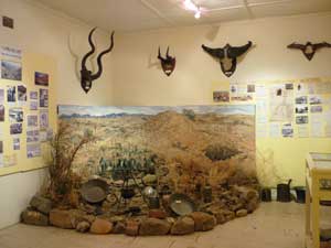
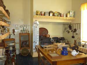
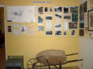
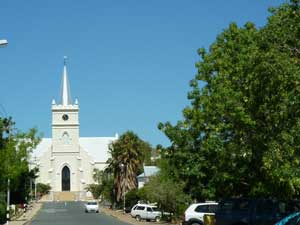
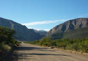
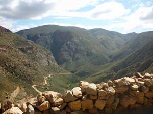
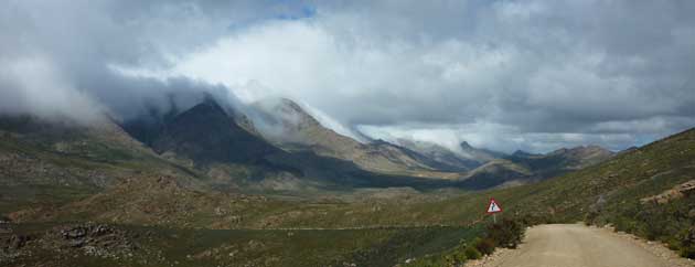
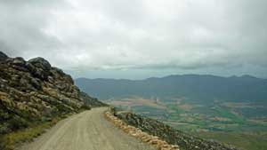
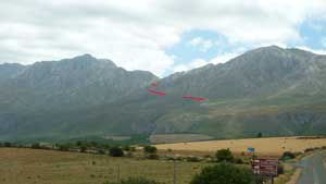
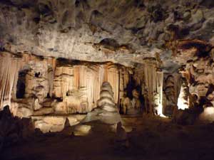
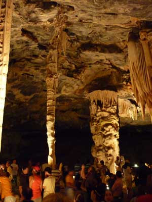
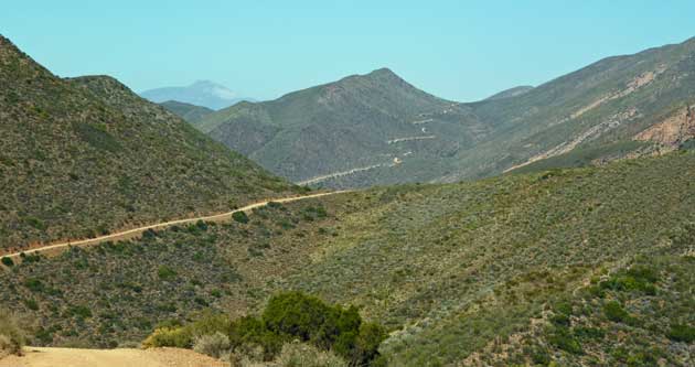
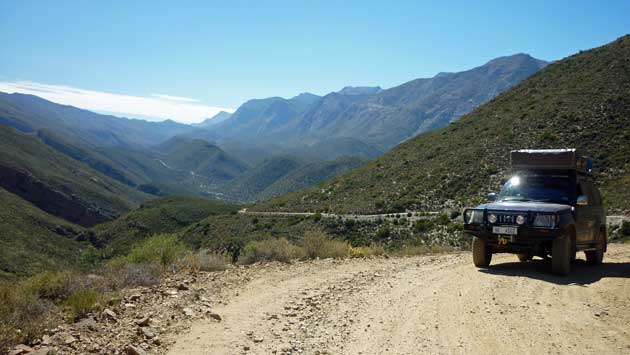
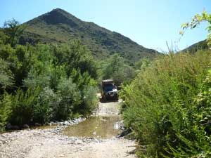
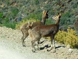
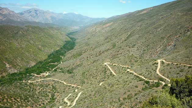
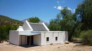
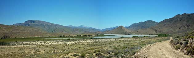
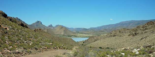
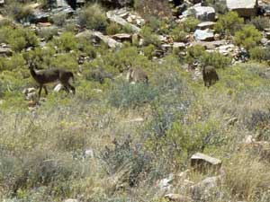
We'd booked 5 nights at a farm in Prince Albert, a small farming town to the north of the Swartberg mountains. Thomas Baines was a road builder in the 19th century who was responsible for building several passes in the Western and Eastern Capes, over mountains and often in places where many others said was impossible. He would plan out the route on foot , draw up plans and then use convict labourers to build the passes. Between Knysna and Prince Albert we drove over Prince Alfred's Pass, a single track gravel road along narrow gorges and across valleys and mountains. This is the view down into Prince Albert's valley. There was an interesting museum with lots of rooms showing the development of the surrounding area. This display gave information about the gold rush that occurred briefly in this district. Old kitchen utensils in the Museum. The Swartberg Pass was another of Thomas Baines' magnificent mountain passes and there was a section with information about the planning and building of the Pass The Dutch Reform Church on Prince Albert. We wanted to visit the Cango Caves which were on the Southern side of the Swartberg Pass. It's mostly a single track gravel road with plenty of zig-zags and superb views. The approach to the Pass in the North looks straightforward but it soon starts winding through a gorge and then winding up the mountains. The start of the Pass. From 3/4 of the way up looking back down the Pass. The tops of the mountains were often cloud covered. On the way down with the Ootshoorn valley in the distance. Looking back to the pass from the South. The red lines indicate the route of the road. The Cango Caves are a vast underground network of caves of which a small part are open to the public There were about 120 people altogether in our group to start with but the first 2 caves were so huge there was plenty of room. After that we were split up into 3 smaller groups. Apart from the size of the chambers there were some superb examples of water flows, stalactites, stalagmites and pillars We were in the caves for 1 1/2 hours. Another reason that we wanted to visit this area was to drive to Gamkaskloof, better known as Die Hel (The Hell). It's not know why it got that name but perhaps it’s because it was so difficult to get there. Gamkaskloof is a valley in the Swartberg mountains about 20km long and up to 800m wide but until the 1960s there was no road into the valley. The only way in, or out, was by foot, following the river along a narrow steep sided gorge. The inhabitants farmed in the valley (fruit, vegetables, sheep, goats and cattle) and every month or so the farmers loaded their donkeys with goods and set out on the 10km trek to Prince Albert, which took all day. By road it’s now 50km from Prince Albert, up to near the top of the Swartberg Pass and then turning off to the West along the Otto du Plessis Pass. At first it’s an easy gravel road through fynbos but then it becomes a single track road though a narrow valley and then up and down over various passes. The road looking West. Looking back to the East from near the top of the Pass. We crossed several streams, some were dry but others had water and plenty of vegetation. We saw several groups of klipspringers. This family seemed to want to stay on the track. Finally we came to the top of the pass above Gamkaskloof where there was a superb view of the road zig-zagging down the hillside and into the narrow valley. Once down we drove along the valley floor, stopping from time to time to see some of the houses. After the road was completed and the inhabitants were able to travel more widely they gradually started selling their land and leaving the valley. Nowadays there are only a couple of families left and the rest of the valley has been taken over by Cape Nature who have restored some of the houses which are used for self catering accommodation. One of the reasons that a road was needed to access Gamkaskloof was because a dam was built upstream so the 'kloofers' could no longer walk upstream through the gorge. On our last day in the Swartberg we visited the dam and had a picnic beside it. 1. Mountain Zebra National Park Diary (Word '97 document) We saw several groups of grey rhybok near the dam.
Christmas 2009 - South Africa - Swartberg Mountains