UK
South Africa
Botswana & Namibia
Zimbabwe & Mozambique
Zambia & Malawi
Cruises
Campsites
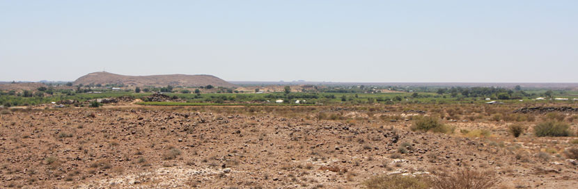
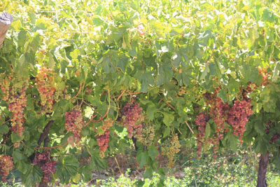
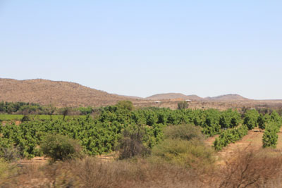
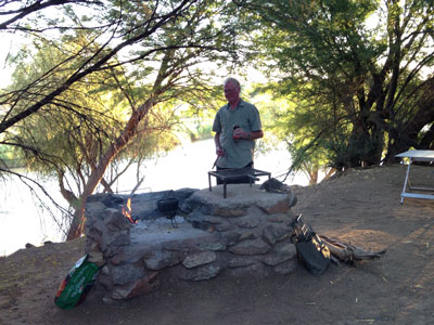
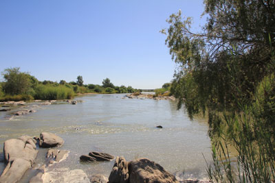
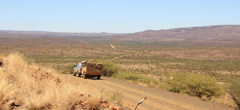
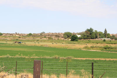
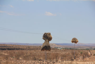
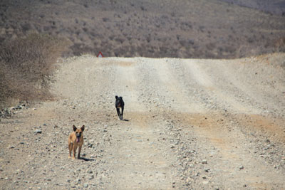
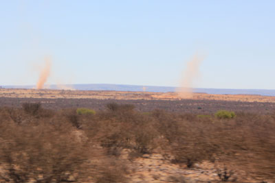
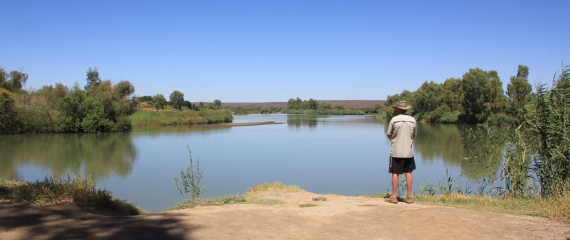
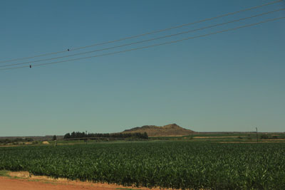
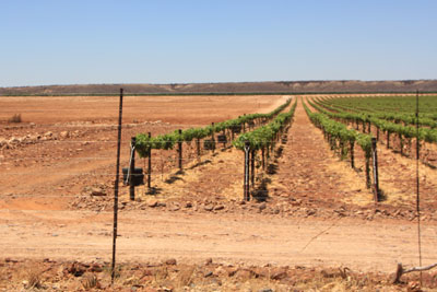
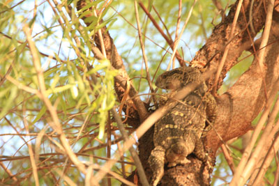
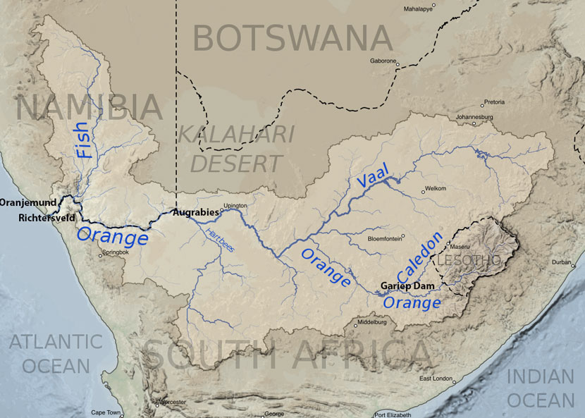
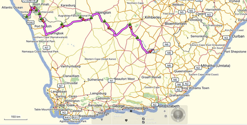
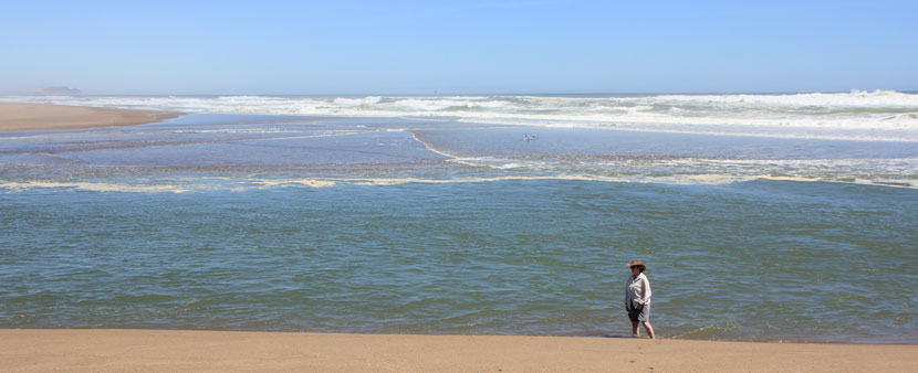
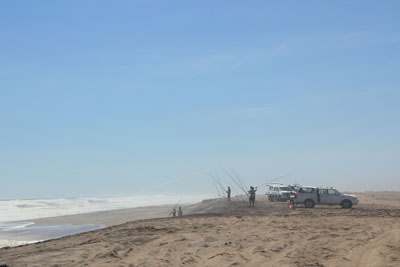
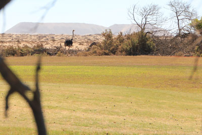
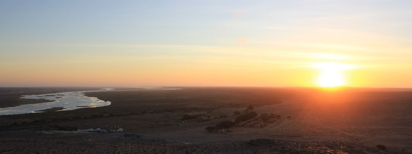
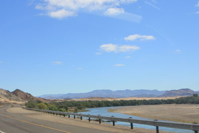
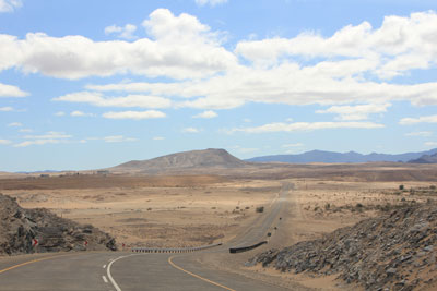
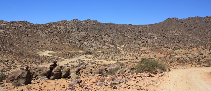
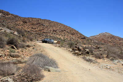
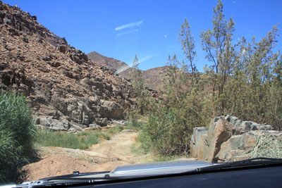
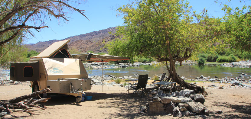
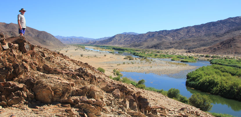
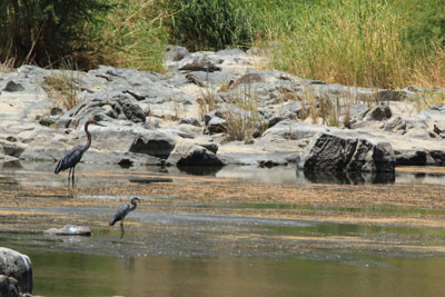
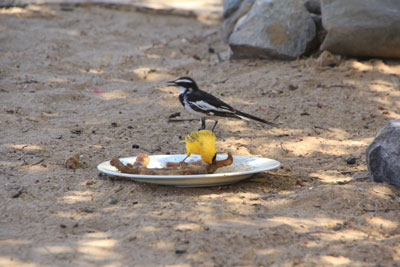
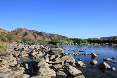
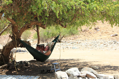
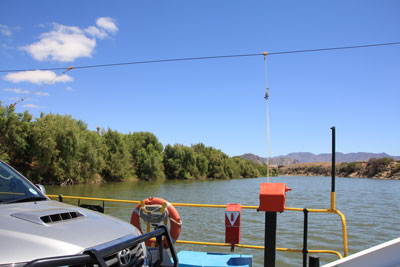
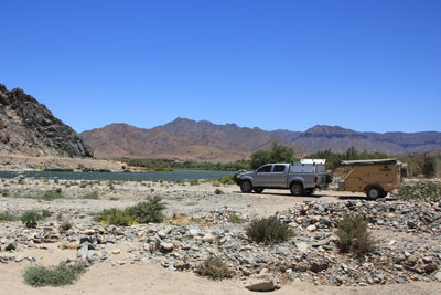
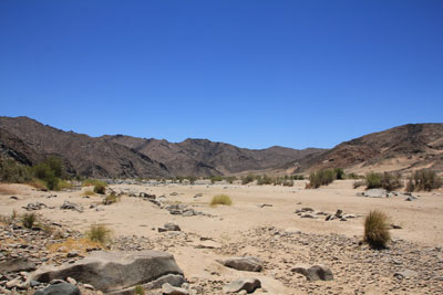
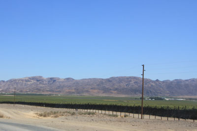
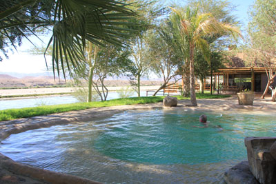
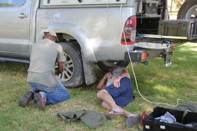
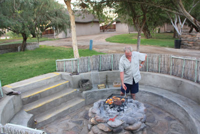
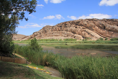
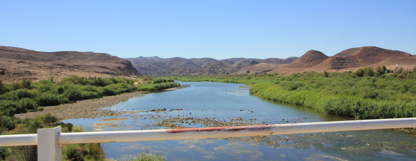
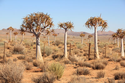
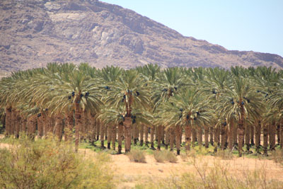
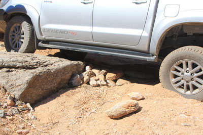
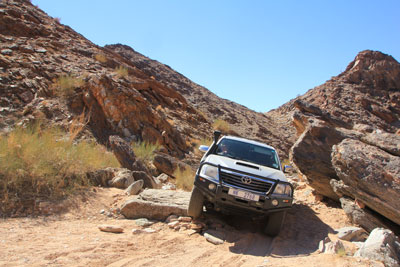
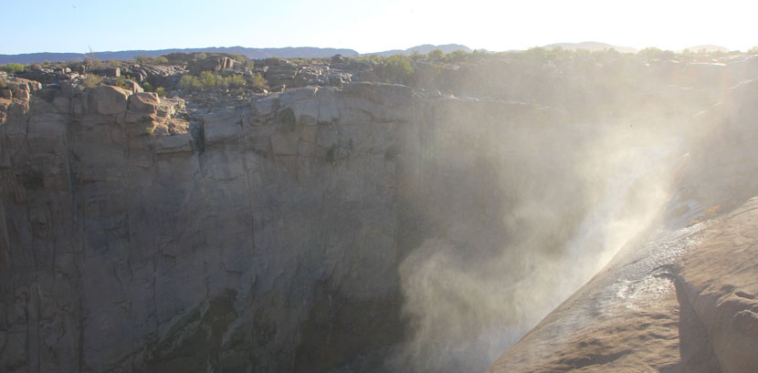
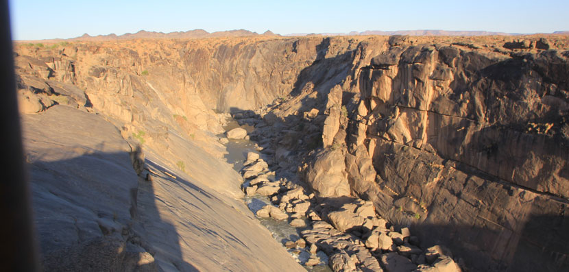
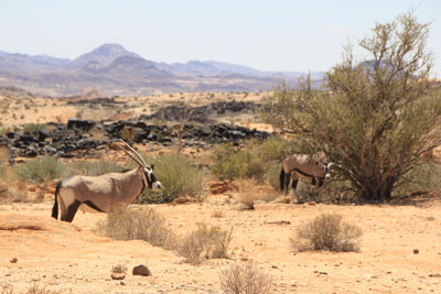
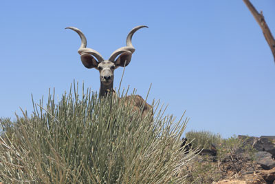
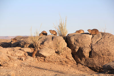
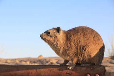
The Orange River is the longest river in southern Africa, about 2,000 kilometres long. It rises from the Drakensberg Mountains in Lesotho, and flows westward through South Africa and enters the Atlantic ocean on the South African/Namibian border. The Orange River is also know as the Gariep (pronounced Hareep) River. As far as possible we followed the course of the river and tried to keep to the back roads. Standing at the point where the Orange RIver enters the Atlantic Ocean. Last year I read in a magazine: As we were on the Namibian side of the river we were able to drive along the beach (no longer allowed in South Africa). On our way back to Oranjemund we saw an ostrich family on the golf course - by the time I'd got my camera out only 'dad' was in sight. We drove to the top of the hill behind the campsite to watch the sun go down. Driving East to the north of the river it was incredibly dry apart from a narrow ribbon of trees along the river. We saw occasional mine buildings. You are not allowed to drive off the road here as you are driving through the Sperrgebiet. This was, undoubtedly, our favourite spot on this trip. In the 4 days we were there we only saw 2 other vehicles! It took us 2 1/2 hours to cover the 45km from the office at Senderlingsdrift to the De Hoop campsite. The Akkedis Pass was the main challenge with a twisty, narrow, rocky single track - luckily we met no other vehicles. You can just make out some of the route in the photo below. We were very pleased with how well the van coped with the track. Towards the river we had to drive down a narrow, sandy stream valley. We spent the best part of an hour looking at the different spots where we could camp and ended up at this beautiful spot next to the Orange River. Early one morning, before it got too hot, we took a walk along the hills behind the campsite. We saw plenty of birds while we were there. A Grey heron (foreground) with a goliath heron at the back. Wagtails and Weaver birds enjoyed scraps that we put out. We had several dips in the river every day to cool off. Kevin enjoying his hammock under a shady tree. After driving back to Senderlingsdrift we crossed back over the River and then followed the road which, for the most part, followed the river for a couple of days stopping at a couple of campsites along the way. Crossing the Orange River from Senderlingsdrift on the pontoon. We were able to stop for lunch right next to the river. We crossed the Fish RIver which is a tributary of The Orange River - it was completely dry,. As we approached Aussenkehr we saw the first of many vineyards irrigated by The Orange river. Just outside Aussenkehr we stopped for a couple of nights at Norotshama River Resort . The first morning we noticed that we had a flat tyre. There were no garages nearby but the maintenance manager helped Kevin remove the wheel and then took him to a local vineyard which had a tyre repair garage. We enjoyed several dips in the pool at Norotshama which had great views across the Orange River. Removing the tyre. Our campsite braai area at Norotshama. The next day we moved about 50 km to Amanzi RIver Camp for a night. This was the view from our campsite. Crossing The Orange RIver back into South Africa. I'd read that this was the largest date farm in South Africa and that they had a River Camp. O our way to Klein Pella we passed through a Quiver Tree forest. We passed several large date plantations. When we eventually found someone round the back of the house (the office was shut) we asked about the RIver Camp and were told we could go there but she didn't have a detailed map or any co-ordinates. There was a sign to the river near the buildings which we followed but after a few kilometres we came to a junction with no signs. Our Tracks4Africa GPS showed the tracks so we followed them and, after a while, saw another track which looked like it went down to the RIver so we turned off and followed it. A km or so later we came to a rock obstacle and some very soft sand. After deflating the tyres and building up one side of the obstacle, Kevin drove while I directed him over the rock only to find another km further on that the track stopped quite a way from the river!! Fortunately there was just enough room to do a 9 point turn and then we had to drive back over THE ROCK! i was so busy directing that I only manged a couple of photos. Eventually we drove back to the Lodge and stopped at their campsite for the night. We had to build up a platform so the back wheel could get over the rock. Coming back over the rock. The Orange RIver passes through a narrow gorge and down a long waterfall. There wasn't much water in the river when we were there . Looking upstream towards the waterfall. Downstream. We had a drive around the Park. It was extremely dry but we did see game - zebra, oryx, springbok and kudu. Oryx. A male kudu. On our early morning walk around the Falls we saw lots of dassies basking in the early morning sun. We mostly kept to gravel roads and took our time to drive towards the Drakensberg, stopping at 4 camps next to the RIver. As we headed East we saw more and more irrigated land near the river, however the rest of the land was dry, dry, dry! The most frequent crop we saw was grapes - for wine, eating and drying. Orchards of fruit and nuts were common. Most had racks fro drying the fruit. The campsite at Kheis overlooked the river. The Orange RIver at Kheis. Sometimes there was no road near the river so we meandered along gravel roads through the dry countryside. Irrigated grass fields and hay bales being made. We saw several sociable weaver nests. In the middle of nowhere we came across these dogs trotting down the road. Dust devils in the distance. The confluence of the Orange and Vaal Rivers - each had more water in them than we saw much further downstream which shows just how much water is taken out for irrigation and also how many people depend on the river for their livelihood. Further east we saw more maize being grow. We saw new fields and vineyards along the way. There must be a limit as to how much water can be taken from the river. 1. Across The Karoo to Oranjemund. 2. Following The Orange RIver upstream. A tree monitor without a tail which we saw at a campsite.
Orange RIver. January 2019.
2. Following the Orange RIver Upstream.
Oranjemund.
"For the first time in its 81 year history, the Namibian town of Oranjemund, which lies in a diamond-rich region called the Sperrgebiet (“prohibited area” in German), is open to the public."
This was one of the reasons we decided to do this trip.
Richtersveld National Park.
Richtersveld to Viooldrift Border Post
Klein Pella
Augrabies National Park
Augrabies to
Gariep.